Settings
Map settings
When recording data in the free roam mode, you can manage the map settings:
- select a map theme
- show priority roads on the map
- enable additional map effects
- enable places on the map
- enable tracking the route
Theme
To switch between color (light) and dark themes of the map:
- Tap the round map icon in the lower-left corner.
- Tap
 icon.
icon. - Select the theme.
Priority roads
The administrator can highlight particular roads on the territory as priority. If you work in the free roam mode, make sure to cover priority roads during your detour in the first place.
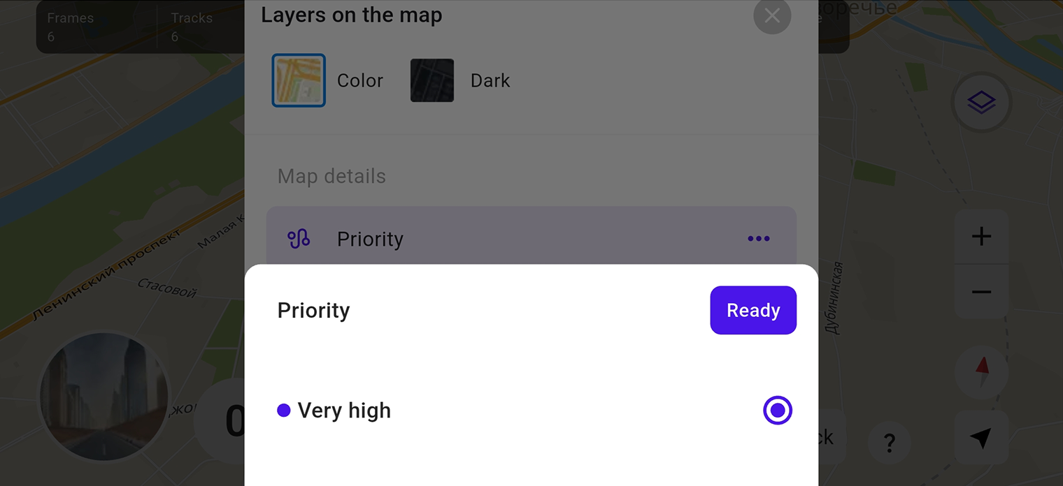
To show or hide priority roads on the map:
-
Tap the round map icon in the lower-left corner.
-
Tap
icon and select Priority. -
Select a required priority level.
-
Tap Ready.
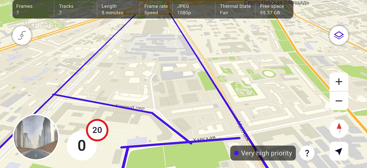
Roads of the selected priority level will be colored on the map. To see which level of priority roads is shown on the map, tap  icon in the lower-right corner.
Map effects
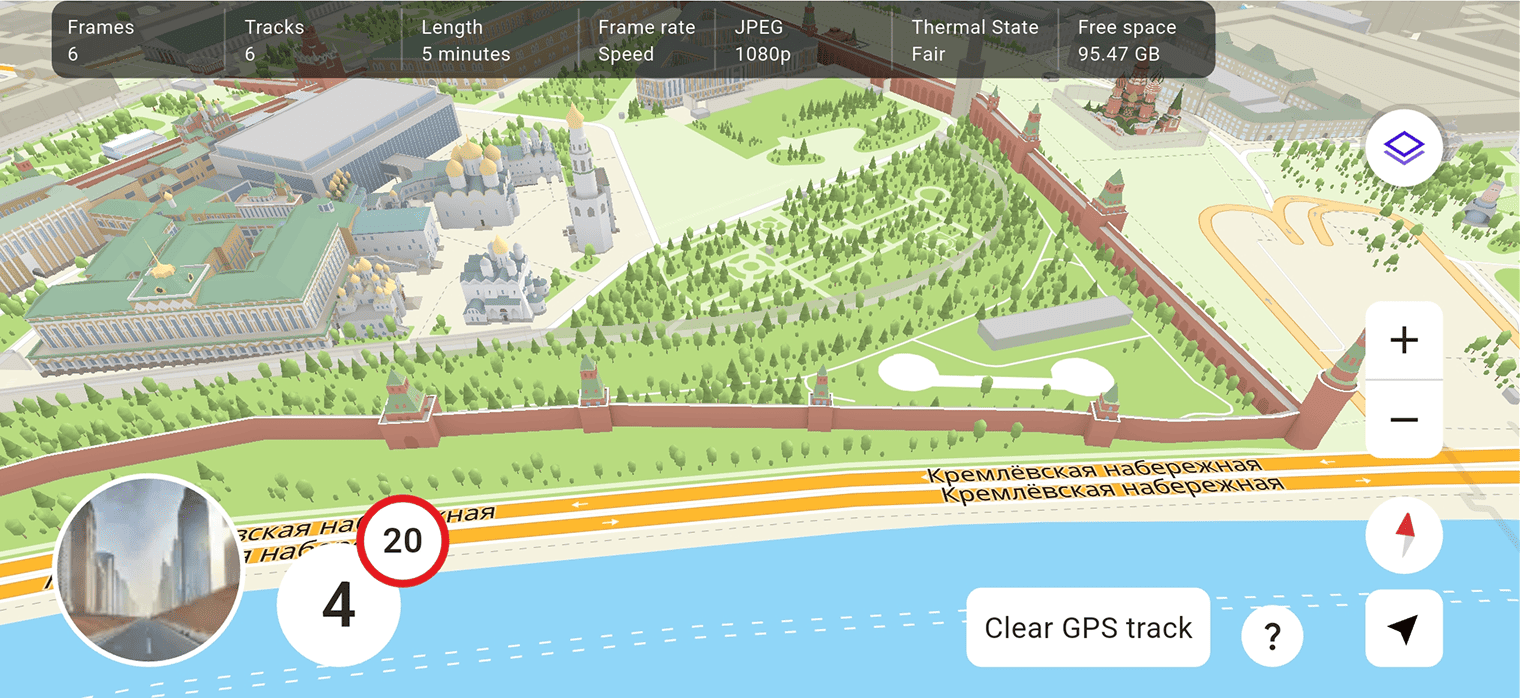
You can make the map look more realistic and enable additional effects.
Displaying realistic objects on the map requires additional resources. When recording, check the thermal state and battery level of your mobile device.
To select the type of effects on the map:
-
Tap the round map icon in the lower-left corner.
-
Tap
icon and select Map effects. -
Select the type of effects:
- Simplified (default): 2D mode with flat objects.
- Standard: with 3D objects.
- Realistic: with additional realistic objects (for example, trees and unique colored buildings).
-
Tap Ready.
Places on the map
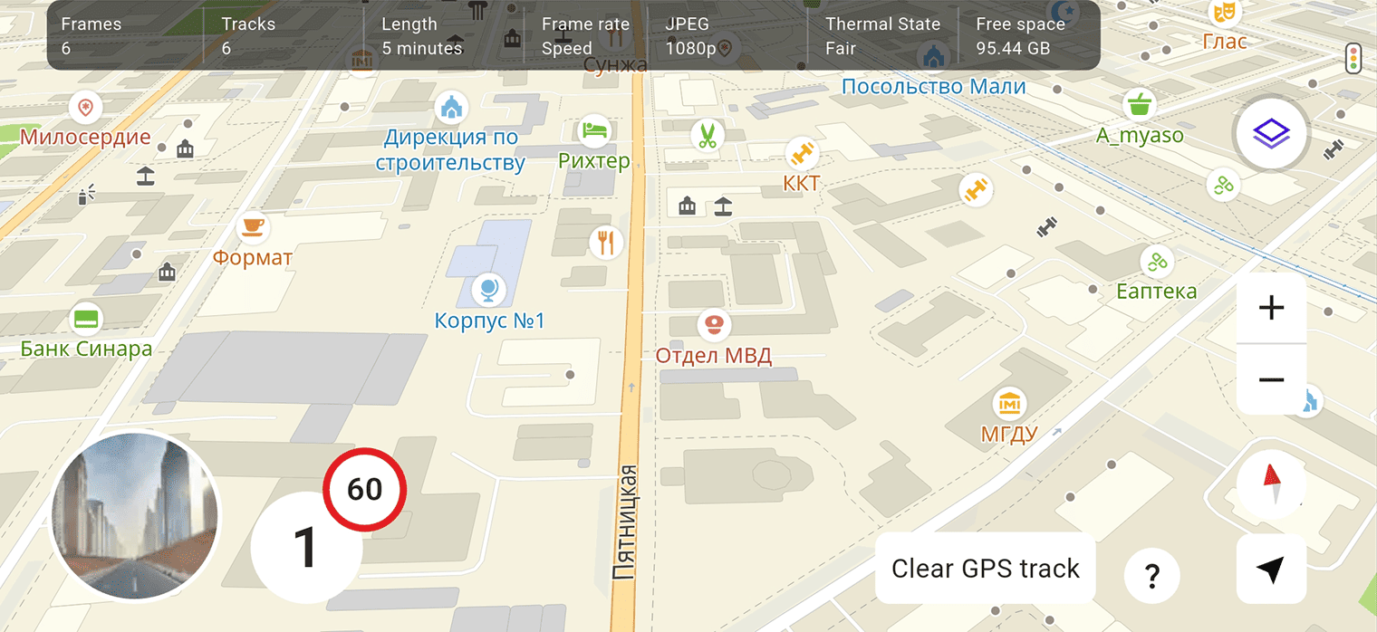
You can enable the display of organization icons (POI) on the map.
Icons are not interactive and do not contain additional information about organizations. They can only help you determine your location on the road.
To display POI on the map:
- Tap the round map icon in the lower-left corner.
- Tap icon.
- Select Places.
Tracking the route
You can enable tracking the traveled route and saving it as a GPS track. It helps you to see areas on the map that you have already visited and plan your next route.
The GPS track is captured only when you are recording videos and is stored in the application.
To start tracking:
- Tap the round map icon in the lower-left corner.
- Tap
 icon. The traveled route is highlighted green on the map.
 - (Optional) To enable the display of the traveled route direction, tap icon and select Traveled route direction. Arrows will appear on the traveled route line.
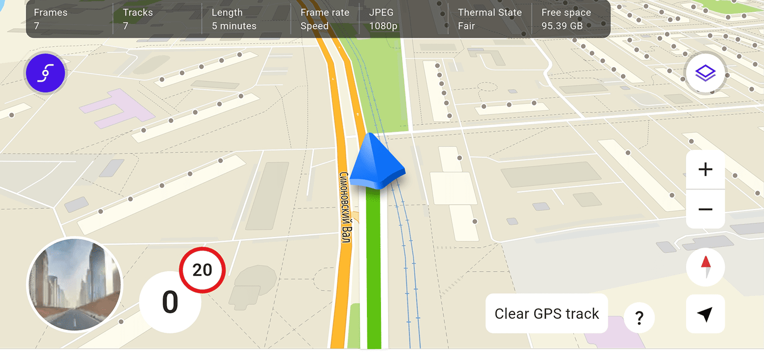
To delete the tracked route, tap Clear GPS track (unless automatic track deletion is configured in settings). Removing the track does not remove captured frames.
General settings
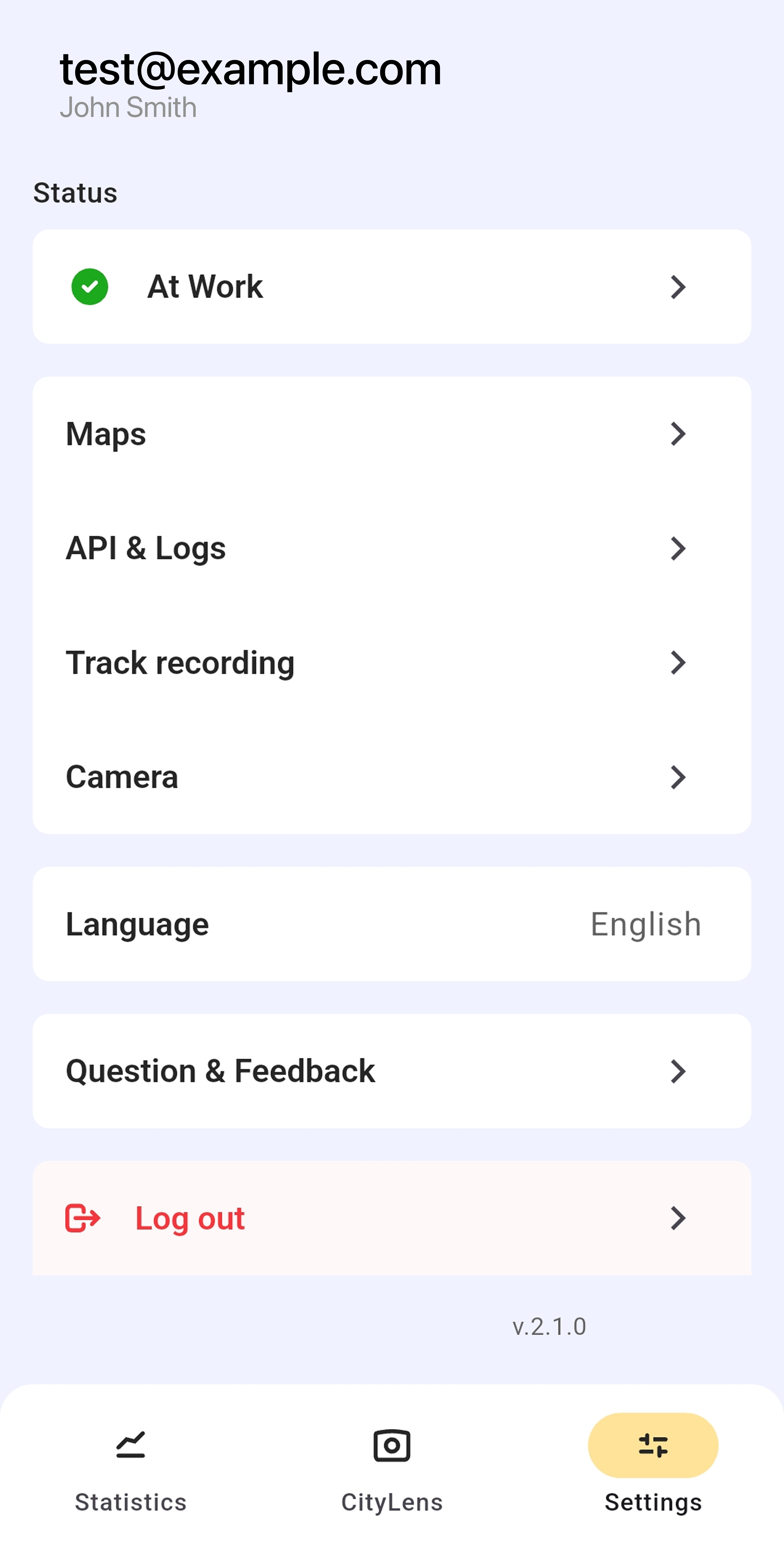
To configure recording parameters, go to the Settings tab or tap  icon while capturing data. Use the following settings:
-
Status: current working status of the driver displayed in administrator tools. Available statuses are:
- At Work: is set automatically when you actively use the application.
- Moved Away: is set automatically when you lock the device or close the application.
- Not Working, Vacation, and Sick Leave: are set manually. You can select one of these statuses to indicate that you are not available to take tasks.
-
Maps: list of offline maps to download and use autonomously.
-
API & Logs: logging settings:
- API URL: copy the address to the clipboard.
- User logs: create a
.txtfile with logs to report an issue. You can download or send these files. - User log management: settings of collecting and storing logs.
- Clear logs: delete log files.
-
Track recording: settings of recording and managing tracks:
- Check connection type: whether to notify you if the device is using mobile data instead of a Wi-Fi connection.
- Collect network data: whether to get geopositioning data from the nearest Wi-Fi access points and cellular towers. With this setting, a device geolocation can be determined better when the satellite signal is weak or unavailable, and other positioning systems perform poorly.
- Track length: the maximum track length in minutes.
- Frame frequency: the frame frequency and what it depends on (the distance, time, or speed).
- Phone placement: car window the device camera is pointed at.
- Clear GPS track: the mode of clearing a GPS track of your traveled route (manual or automatic).
- Track management: export tracks to an external disk (if the local device memory is full) and import them back before sending. This function is available for Android devices only.
-
Camera: camera settings:
- Focus on tap: whether to use a single tap gesture to control the camera focus.
- Auto lower brightness: whether to lower the screen brightness while recording to save battery.
- Exposure: level of camera exposure (amount of light on images). By default, the value is configured automatically, but if your images are too dark or too light, you can set a custom exposure level. To do it, disable the auto mode and move the slider: negative exposure values make images darker, and positive values make them lighter.
- Image resolution: select the resolution of captured images.
- JPEG quality: select the compression of exported JPEG images.
-
Language: select the application language. For Arabic, right-to-left (RTL) orientation of the UI is supported.
-
Questions & Feedback:
- FAQ: see responses to the frequently asked questions.
- Send Feedback: send a message to technical support. You can attach a log file to the message if you have an issue with the application.
The current version of the mobile application is displayed in the lower part of the screen.