Drivers
The Drivers dataset provides information about drivers authorized in CityLens and routes covered by them.
Getting started
- Go to the Main or Data tab.
- Select the All Drivers CityLens dataset.
- In the Geofilter settings dialog, select up to 50 territories for which the data sample is created. You can use standard and custom territories and also build polygons, proximity zones, and circles on the map. For more information, see the Geofilters section. After you select the territories, click Done.
- On the Filters tab, set the remaining filters if necessary.
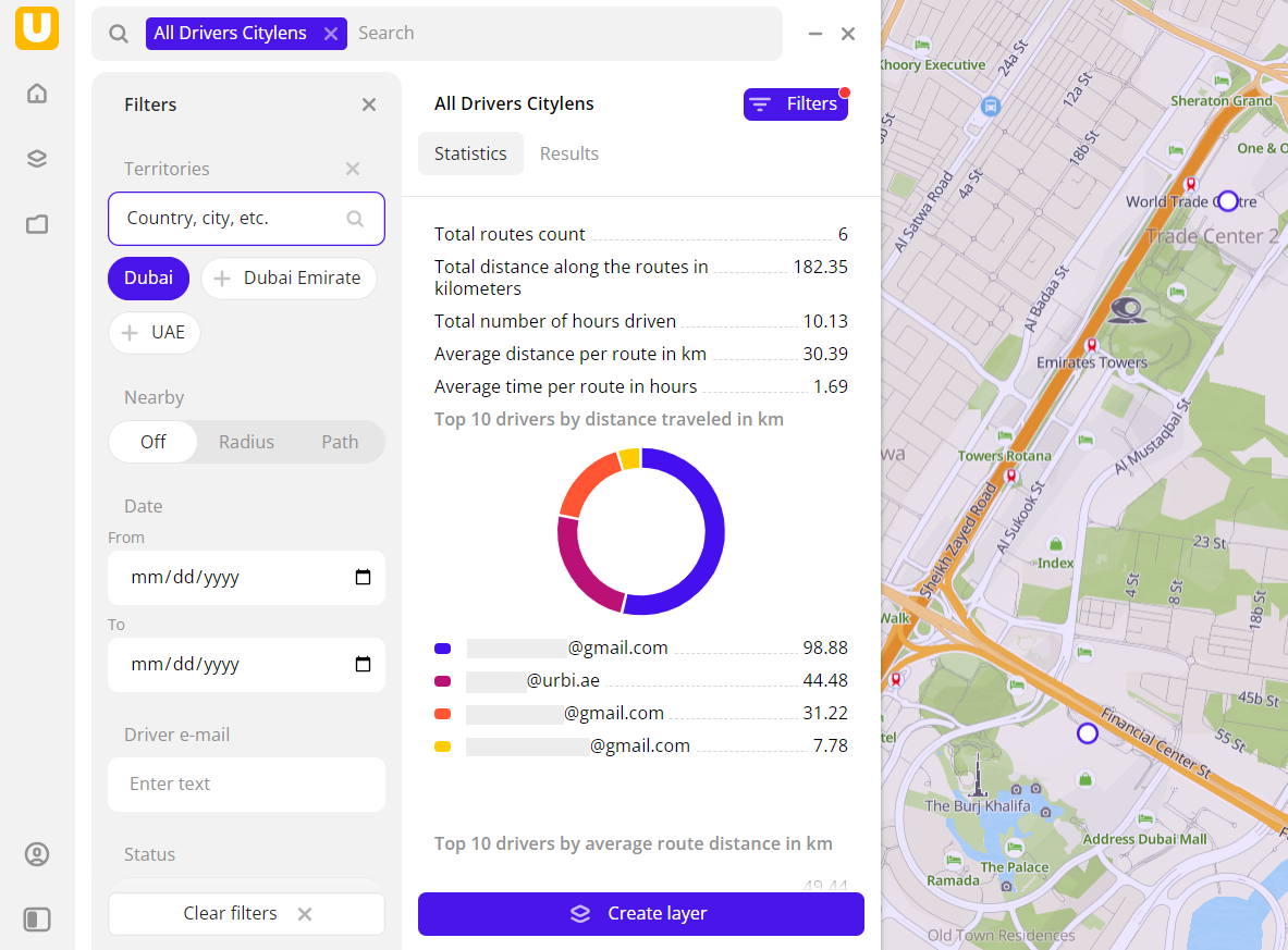
The data is displayed on the map as lines (covered routes). Filtering results are available on two tabs:
-
Statistics: general statistics about the sample:
- Total count of routes.
- Total covered distance.
- Total number of hours driven.
- Average distance per route.
- Average travel time per route.
- Chart with the top 10 drivers by total covered distance.
- Chart with the top 10 drivers by average distance.
- Chart with the top 10 drivers by average travel time.
-
Results: list of driver emails sorted alphabetically. When selecting a driver from the list:
- Information about the driver is displayed in the card.
- Last recorded driver location is displayed on the map (to zoom in, click Show on map).
You can manually edit the list of filtering results to keep only particular drivers in the data sample. To do this, click Edit list, select the drivers, and click Apply.
To save the data sample, click Create layer and customize data visualization.
Filters
For the Drivers dataset, the following filters are available:
- Date: when a driver completed the route. You can set a time frame to limit the sample.
- Time zone: time zone of a driver.
- Driver e-mail: enter an email to show results for a particular driver only.
- Status: status of processing the data uploaded by a driver.
- Distance: distance traveled by a driver while working on tasks in a day.
- Duration: time spent by a driver while working on tasks in a day.
To reset the parameter filter, click ![]() icon next to the filter name. To reset all parameter filters, click Reset filters at the bottom of the tab.
icon next to the filter name. To reset all parameter filters, click Reset filters at the bottom of the tab.
To hide the filter by territory, in the Geofilter settings dialog, click ![]() icon next to the geofilter name. To delete the geofilter, click
icon next to the geofilter name. To delete the geofilter, click ![]() icon next to its name. To delete all geofilters, click Clear filters.
icon next to its name. To delete all geofilters, click Clear filters.