Frames
The Frames dataset provides information about frames (images bound to geographic coordinates) captured by the CityLens drivers.
Getting started
- Go to the Main or Data tab.
- Select the All Frames dataset.
- In the Geofilter settings dialog, select up to 50 territories for which the data sample is created. You can use standard and custom territories and also build polygons, proximity zones, and circles on the map. For more information, see the Geofilters section. After you select the territories, click Done.
- On the Filters tab, set the remaining filters if necessary.
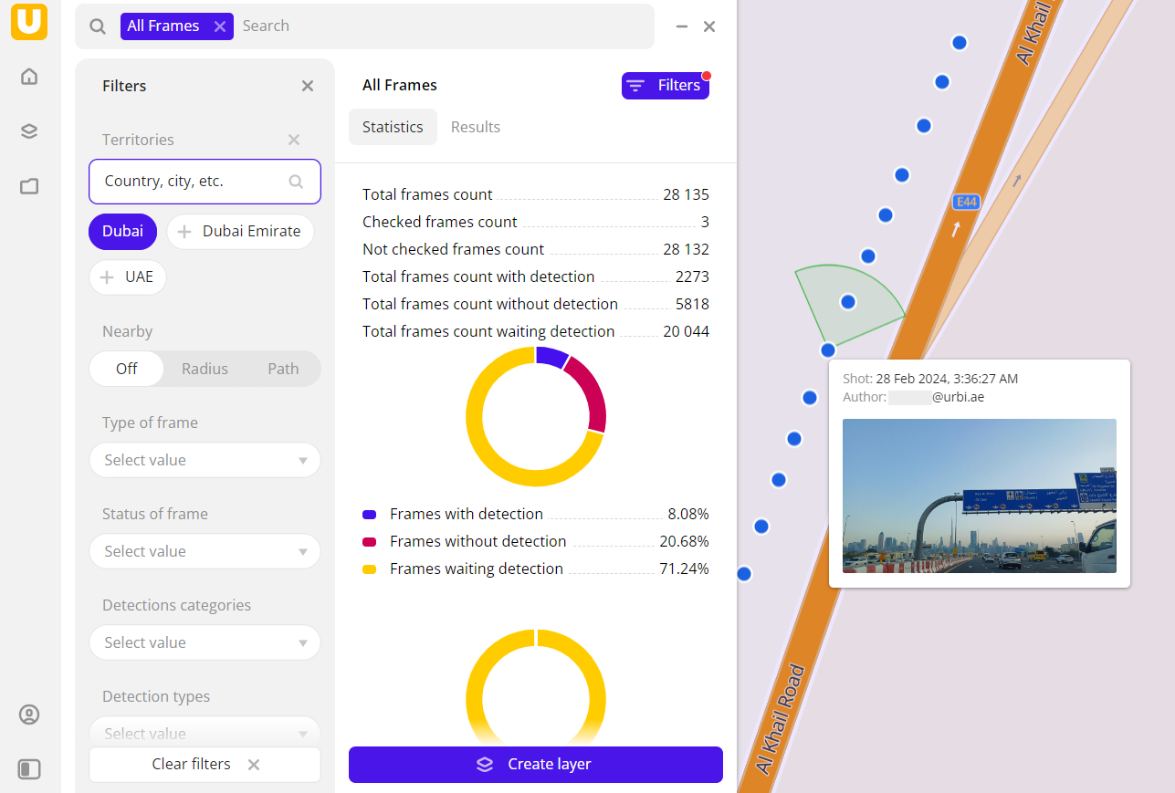
The data is displayed on the map as centroid points: the centers of the object geometries. Filtering results are available on two tabs:
-
Statistics: general statistics about the sample:
- Total count of frames.
- Count of not checked frames.
- Count of frames with detected objects.
- Count of frames with uncompleted detection.
- Chart with the distribution of frames by detection status.
- Chart with distribution of frames by detection categories (detectors).
-
Results: list of frames. When selecting a frame from the list:
- Information about the frame is displayed in the card.
- Frame location is displayed on the map (to zoom in, click Show on map).
You can manually edit the list of filtering results to keep only particular frames in the data sample. To do this, click Edit list, select the frames, and click Apply.
To save the data sample, click Create layer and customize data visualization.
Filters
For the Frames dataset, the following filters are available:
- Type of frame: indicates if objects in the frame are detected.
- Status of frame: status of checking the frame.
- Detection categories: categories of urban environment objects that can be detected.
- Detection types: urban environment objects that can be detected.
- Date: when a frame was captured. You can set a time frame to limit the sample.
- Driver: enter an email to show frames captured by a particular driver.
To reset the parameter filter, click ![]() icon next to the filter name. To reset all parameter filters, click Reset filters at the bottom of the tab.
icon next to the filter name. To reset all parameter filters, click Reset filters at the bottom of the tab.
To hide the filter by territory, in the Geofilter settings dialog, click ![]() icon next to the geofilter name. To delete the geofilter, click
icon next to the geofilter name. To delete the geofilter, click ![]() icon next to its name. To delete all geofilters, click Clear filters.
icon next to its name. To delete all geofilters, click Clear filters.