Population
The Population data category provides information about living and working populations with selected filters.
Overview
To get started:
- Go to the Main or Data tab.
- Select the Population data category.
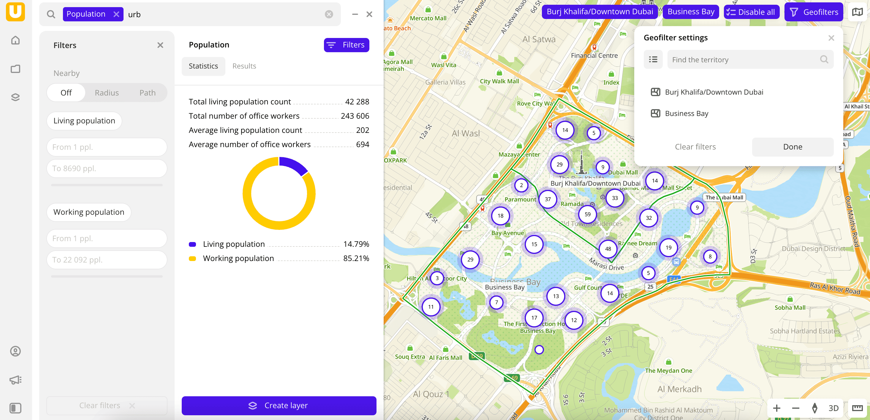
- On the Filters tab, select a Territory.
- Set the remaining filter parameters if necessary.
The data is visualized on the map as centroid points: the centers of the object geometries. Text results are available in two variants:
-
Statistics: general statistics about the sample. Include:
-
Total and average count of the living population.
-
Total and average count of office workers.
-
Chart with the count of living and working populations.
-
Results: list of buildings where the population lives and works. Includes:
-
General information about the population.
-
List of buildings.
When selecting a building from the list:
- The address of the building and the count of living and working populations is displayed on the next tab.
- The location of the building is indicated on the map.
-
To save this data sample and customize its visualization (e.g., as a heatmap), click Create layer.
Filters
For the Population category, the following filters are available:
-
Territories: country and city selection. You can select no more than 5 cities per country. There may also be restrictions depending on the prices. Required for selection.
-
Edit categories: selecting categories of organizations. You can select multiple subcategories only within one category.
-
Nearby: limiting the data sample by territorial availability. Possible options:
- Off: default value.
- Radius: circle with a radius from
10to100000m around a point on the map. The default value is10000m. - Path: area on the map that is accessible by car or on foot within
5to30minutes. The default value is15min.
To change the area, drag the center point to the necessary area of the map.
-
Living population: living population in the building.
-
Working population: working population in the building.
To reset the filter, click ![]() icon next to the filter name. To reset all filters, click Reset filters at the bottom of the tab.
icon next to the filter name. To reset all filters, click Reset filters at the bottom of the tab.
How the data is collected?
Algorithm of counting the living population contains the following steps:
-
Calculation of the living area of buildings on a given territory.
The Urbi directory provides information on buildings on the map. For further prediction of living population, buildings are classified as follows:
- Buildings with a known number of apartments (for example, a building with multiple floors). Calculation of the living area is based on the number of apartments and the apartment area norm in the given city.
- Buildings with no information on apartments. Calculation of the living area is based on the building geometry. Non-residential areas (parking lots, non-residential first floors, commercial areas on multifunctional complexes) are excluded.
- Private houses. Normally, one family lives in each building. This information is sufficient for further calculation and the living area is not used.
-
Prediction based on housing standards:
- For private houses: average size of a family.
- For other house types: the living area size (calculated on the previous step) divided by the standard of the living area for one person in the given country or city.
Information on housing standards (average apartment square, average family size, and more) is provided by the statistics department of the country, statistics agencies, or other public sources.
-
Correction based on the population census.
This step helps correct inaccurate values for a city or district if many inhabited buildings (for example, a high-rise apartment building not yet put into operation) are located in the area or the population density significantly deviates from the average numbers.
What's next?
- Quick start.
- Get to know more about other Data categories.
- Get to know how to work with Data visualization.
- Get to know more about Layers, Dashboards, and Widgets.
- Get to know prepared Analytics presets.